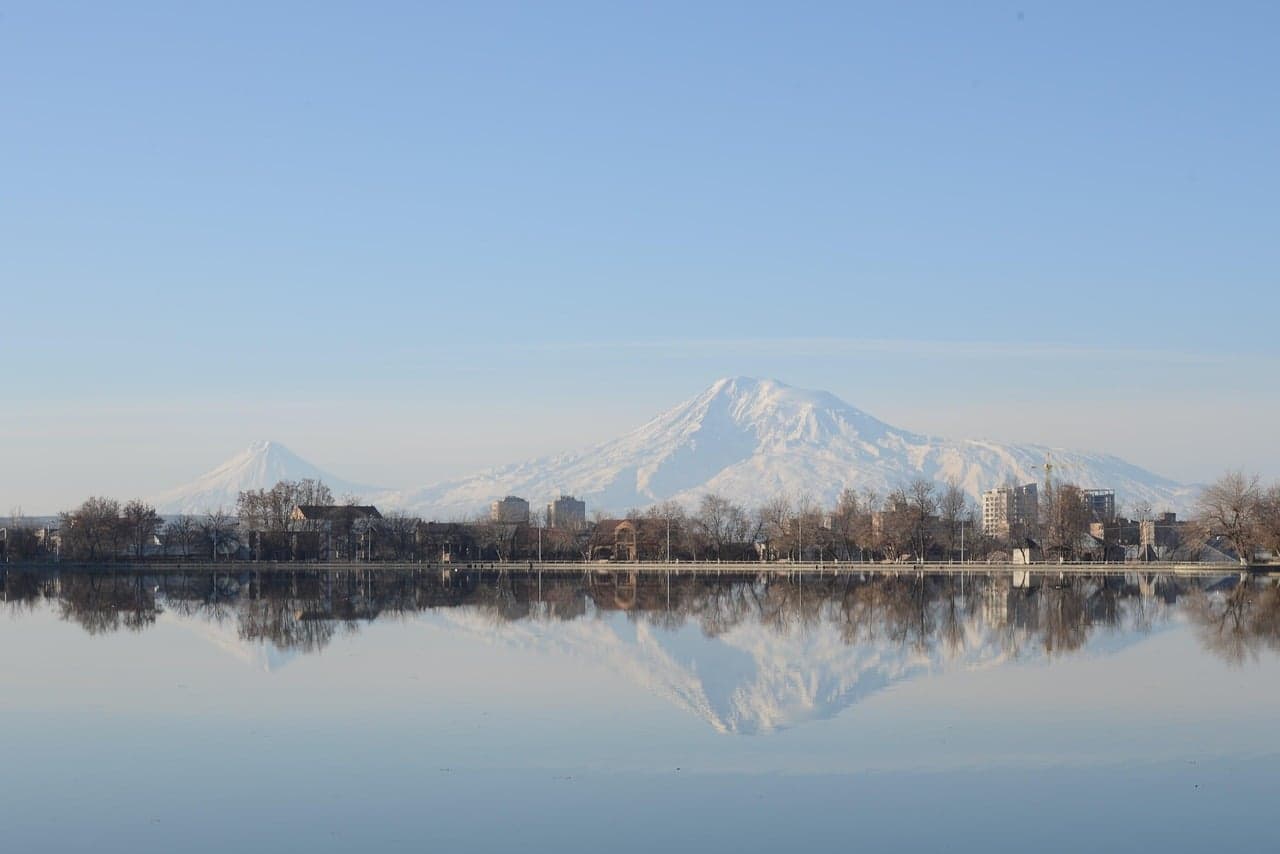
Iğdır is built around a view: Mount Ararat, Türkiye's highest summit, rises above the plain and frames almost every stop. According to Go Türkiye, the plain is low and hot while the surrounding mountains are high and cool, so all four seasons can be felt at once. Add a Seljuk caravanserai, ram-shaped tombstones, the salt caves of Tuzluca and one of the great bird migration routes along the Aras Valley, and you have a compact history-and-nature trip.
What should first-time visitors see in Iğdır?
The central stops are spread across the plain; by car you can cover them in half a day.
The ram-headed tombstones in old cemeteries date to the Kara Koyunlu period and trace their roots to Central Asian Turkic culture. Carved from black basalt and local tuff, only a few survive and those are protected. Look closely at the motifs, but do not climb on or touch the stones.
The Harmandöven Ejder Caravanserai stands about fifteen kilometres from the city centre on a branch of the Silk Road. Built in the thirteenth century, it is counted among the last monumental works of the Anatolian Seljuks and keeps the fortress-like plan of their caravanserais. The small conical-roofed Çakırtaş Kul Yusuf Tomb, roughly eleven kilometres north of the centre, fits into the same half day, as does Karakale, a late twelfth-century Seljuk fortress above the Aras River, according to the Iğdır Municipality. Check with local official sources that access to the fortress is open before you go.
What is at the foot of Mount Ararat?
The extinct volcano rises 5,137 metres and is covered by a thick ice cap; the first recorded ascent was in 1829. The best months to climb are July, August and September, and you should confirm permits and guide requirements from official sources before travelling. If you are not a climber, the plateaus on the slopes offer the view.
Korhan Plateau, about thirty-six kilometres east of the centre, holds a castle taken by the Great Seljuks in 1064. The nearby crater long believed to be a meteor impact is in fact a karstic depression about sixty metres deep and thirty-five metres wide. The Ahura ruins layer Urartian, Persian, Roman and Byzantine remains.
Where do you watch nature along the Aras Valley?
In Bulakbaşı village, the Karasu stream fed by Ararat's waters shelters wild ducks, storks and herons, and, says the municipality, a water-monkey species that in Türkiye lives only in Edirne and Iğdır. The valley sits on the migration route between Africa and Eurasia, where hundreds of thousands of songbirds and raptors pass every spring and autumn. Bring binoculars.
What is worth seeing in Tuzluca?
The Tuzluca salt caves are tunnels in a broad salt-covered area; walking between white walls is one of the province's most unusual experiences. The Rainbow Hills west of the district show red, brown, grey and yellow stripes, best in the soft afternoon light. Üçkaya Lake turns yellow and brown in autumn, and Balıklı Lake, at 2,241 metres, is described by the municipality as Türkiye's highest lake.
What do you eat in Iğdır?
Bozbaş, cooked and served in a mug with chickpeas and lamb, is the province's emblem. Turmeric-coloured sour pilaf with lepe is made for holidays; also try katlet meatballs, hörre and aubergine jam. Şalak apricots start ripening in the last week of June, and their sweet kernels are eaten like nuts, Go Türkiye notes.
Okur için: how many days, when and how to get there
Two days is ideal. Day one: tombstones, Ejder Caravanserai, Kul Yusuf Tomb and Karakale, then the Karasu stream at Bulakbaşı in the evening. Day two: Tuzluca's salt caves, Rainbow Hills and Üçkaya Lake. Add Korhan Plateau, the crater and Ahura on a third day if you have time.
Spring and autumn are the most comfortable seasons for sightseeing and birdwatching; the plain is hot in summer. Reach Iğdır by air or by road from Kars and Ağrı. You need a car for Tuzluca, Korhan and Bulakbaşı. Check current visiting conditions of museums and sites on their official pages, protect fortresses and cemeteries, and spread walks over morning and late afternoon in summer. For more routes, see City Routes.
Frequently asked questions
How many days do you need in Iğdır?
Two days cover the main stops: the caravanserai, tombstones and Karakale on one, Tuzluca on the other. Korhan Plateau needs a third.
When can you climb Mount Ararat?
July, August and September are the best months. Check permits and guide requirements with official sources first.
What should you eat in Iğdır?
Bozbaş, turmeric lepe pilaf, katlet, hörre and aubergine jam stand out, along with şalak apricots from late June.
Editorial desk
Stories signed by the Cultvia editorial desk follow our editorial policy; every story lists its sources at the end and errors are fixed under our corrections policy.
Last updated:
What changed?
- : First published
Sources
- Gör Iğdır — Go Türkiye, 22 October 2026
- Tat Iğdır — Go Türkiye, 22 October 2026
- Şehir Turizm — Iğdır Municipality, 22 October 2026
Up next
 City RoutesParis Photo 2026: opening hours, sectors and what to see13 November 2026 · 1 min read


